Knowing our Fish Creeks on Cha7élkwnech / Gambier Island
In 2023, we released a report titled “Knowing Our Streams; a review of knowledge and stewardship programs of fish-bearing streams within the Átl’ḵa7tsem/Howe Sound UNESCO Biosphere Region”. This report identified gaps in stewardship efforts and the state of knowledge with respect to the overarching goal of conserving these species and their habitats. The report revealed gaps in information on fish-bearing streams on Cha7élkwnech / Gambier Island. This project continues the work that began with the report.
Cha7élkwnech / Gambier is the largest island in Howe Sound, spanning roughly 69 square kilometres of a highly complex landscape. At least ten watersheds lead to the ocean in all directions. These freshwater ecosystems are home to a variety of fish species.
Streams are critical for fish spawning and rearing habitat, meaning that they are threatened by disturbances from the extent of human settlements and forest harvesting in southern coastal BC.
Target creeks on Gambier Island for monitoring. Mannion, Grennon, Whispering, McDonald, and Long Bay Creek.
Fish observations exist in streams on Cha7élkwnech / Gambier, but either data does not exist, or it has not been updated for many years. To ensure the healthy survival of fish, we need to first observe, record and monitor. Initiating a long-term water temperature dataset, documenting species presence, and selecting habitat monitoring sites are the first steps towards monitoring of change in habitat quality over time for anadromous and resident fish and other stream-dwelling species.
There is also a need to encourage the community, through engagement, to care for the creeks and participate in restoration, stewardship and education.
This project is in collaboration with Pacific Streamkeepers Federation, the Gambier Island Conservancy and Fisheries and Oceans Canada and builds relationships with local stewards. We contracted Stamford Environmental to supervise the work, and Sḵwx̱wú7mesh Úxwumixw ACE Technicians have participated in the training and monitoring.
Project Activities
The project’s field season runs from July through December. Read Samantha Wing’s November 2024 blog report about the successful first season. Data on fish presence was submitted to the provincial database; we identified barriers to fish passage and opportunities for restoration. We also completed a full spawner survey in Whispering Creek and established baseline monitoring practices in several creeks across the island.
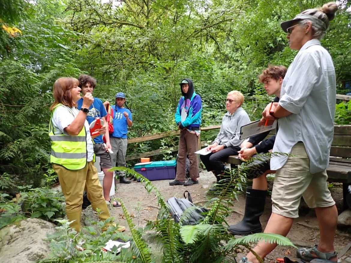
The second field season is underway. In the summer, we co-hosted another streamkeeper training with the Gambier Island Conservancy, led by the Pacific Streamkeepers Federation. This trained a group of Gambier residents in modules from the Streamkeepers Handbook, enabling them to be stewards of their local watersheds.
For more information, or to get involved, contact Sam: OECMprojects@howesoundbri.org
Funding:
Funding support for the 2025 season
Funding support for the 2024 and 2025 seasons
Funding support for the 2025 season.


